the best tours


Gazzirola
Mount Gazzirola is the higher and wider mountain of Southern Ticino, but its thick layer of grass gives it a humble look. Still its position in the middle of the 3 main lakes of the region (Lake Maggiore, Lake Ceresio and Lake of Como) rewards the visitors with an exclusive scenery.
Route
Maglio di Colla - Certara - San Lucio - Rifugio Garzirola - Gazzirola - Alpe Pietrarossa - Colla - Maglio di Colla
Data sheet
Region: Val Colla
Altitude: 2116 m
Ascent: 1338 m
Length: 22 km
Time: 3 - 5.5 hours
Unrideable time: 15 - 35 minutes
Season: May - November
Skills: 4
Strength: 4
GPS Data: download
Map: show
Karte
Watch the diatour
Date: 24 August 2005
Description
This tour begins in Maglio di Colla, a small village that lies on the southwestern ridge of Mount Gazzirola. You have to climb the paved road toward Certara, where you'll find a mountain bike route. Here things will get steeper and more challenging. After an horizontal interlude that will bring you close to Alpe Cottino there is a very steep leg that climbs up to San Lucio's evocative Romanesque church (1542 m), that hangs between Switzerland and Italy and is the center of a yearly gathering between Swiss and Italians shepherds.
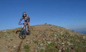
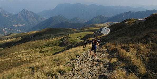
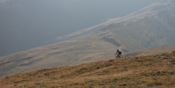
Then you have to head north and face the Italian side of Mount Gazzirola. Up to the Garzirola refuge (1875 m) a steep and bumpy gravel road will force to use short gears. The road stops at the refuge, and the only way to reach the summit is to follow the hiking path. You'll have to carry the bike until you reach the cross, then the path will get a little gentler and you'll be able to pedal up to the summit.
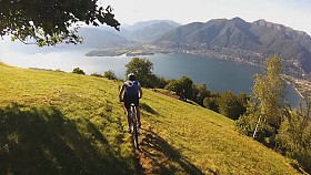
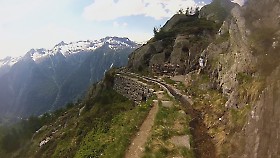
The landscape from Mount Gazzirola range on the woods of Val Colla, and the Italian hills and on the Swiss Alps. On the northern side you will see the steep and wild Val Serdena, while on the eastern side a beautiful mountain chain embraces the Lake of Como.
The descent follows the west ridge, which is tighter and bumpier. The first part is brightened up by an outstanding panorama, but your eyes must be pointed to the shaky path. After a flat section, the path climbs toward Cima Moncucco. Here you have to walk to overcome some difficulties, then you leave the ridge and plounge to the left.

You'll get to a dirt trail that you'll have to follow on the left. You will reach the stone houses of Alpe Pietrarossa, then you'll have to take the trail to Colla. Once you'll reach the paved road, leave it right away on the opposite side, taking a nice gravel road that enters the woods and will take you back to Maglio di Colla.
Latest updates:
Follow me on:


